![94682b08-af4e-42f2-b868-af7439511c70.jpg]](https://support.growdata.com.au/hs-fs/hubfs/94682b08-af4e-42f2-b868-af7439511c70.jpg?height=50&name=94682b08-af4e-42f2-b868-af7439511c70.jpg)
What does Track-Asset do?
- Create fleets (with all vehicles in the fleet grouped together)
- Set service reminders (e.g. service due every 500hrs or 10,000km)
- Monitor engine hours (based on how long ignition has been on - shown on/off in ‘sensors’)
- Easily see if machine is online and where it’s located, as well as the last 10 data points recorded on the map for where it's recently been
- Create geofences for defined areas such as block, farm or machinery shed
- Reports can show which machine drove in/out of each geofence at what times, and distance travelled
- Alerts can be setup to identify when machines move in/out of geofenced areas – e.g. this may be an indicator for theft, or if machinery moves between properties
Viewing Vehicles:
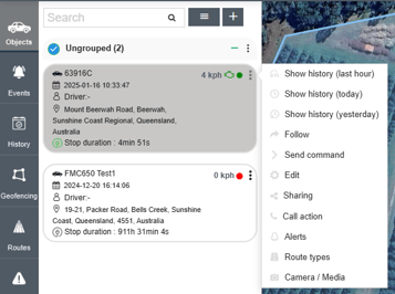
Vehicles can be seen by navigating to the 'Objects' tab on the left of the screen. Here you will see all vehicles associated with the account and an overview of their status, including current speed and location. 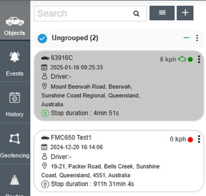
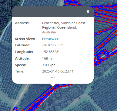
To see more details and exact location of the vehicle, click on the vehicle in the menu to the left of the map, this will now zoom into the vehicle and show more in-depth data and recent movements (green line).
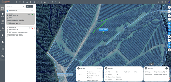
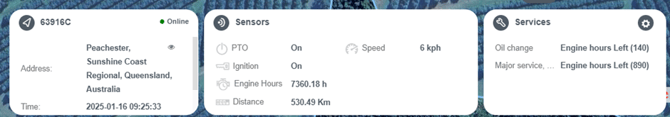
At the bottom of the map, you can see the below information.
- Location
- Local time
- Whether vehicle is online/offline (connected to internet?)
- Speed (km/h)
- Whether vehicle ignition and implement (PTO) ignition are on or off
- How many hours the ignition has been turned on (engine hours)
- Distance travelled
- Upcoming services for the vehicle and engine hours left until each planned service
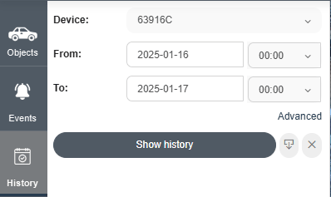
To see an in-depth history of the vehicle's movements, either select the three dots at the top-right of the vehicle panel and select relevant 'show history' option, or you can select 'History' from the grey tabs on the left of the screen. In the 'History' tab you can select device and time range.
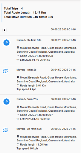
This will show a summary of movements:
As well as all recorded data points for the time range and a timeline of speed/altitude/implement being used (bottom of screen):
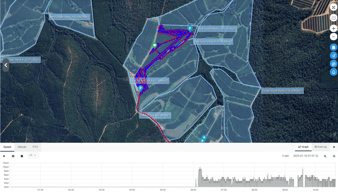
You can also select a data point to see the readings for that specific recording:
Geofencing:
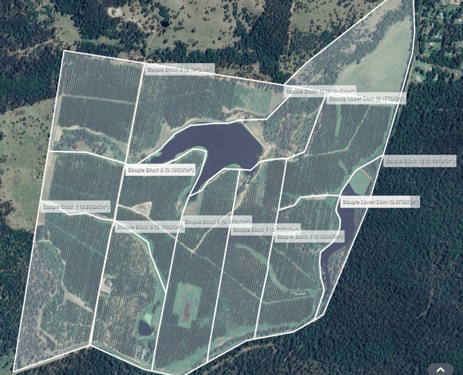
Geofencing can be used to mark out blocks or properties in a farm. These can/will eventually be used to set speed limits in blocks, notifications if a vehicle enters/leaves certain borders, and to set reminders if a vehicle enters a block within a chemical re-entry period after spraying.
Example below, blocks created at the Bauple farm:
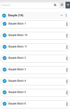
Geofences are set up by going to the "Geofencing" tab on the left of the window. Here you can add geofences by hitting the + button. Enter the name of the block, select shape (circle or polygon), speed limit, and if it's in a group. Groups can be set up to group together all blocks in a farm. In this example, the Group is 'Bauple' as this is the farm. You can see below to the right that the Bauple group has 14 blocks and all blocks included in the group.
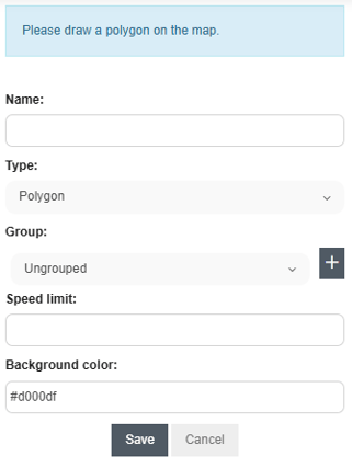
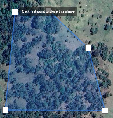
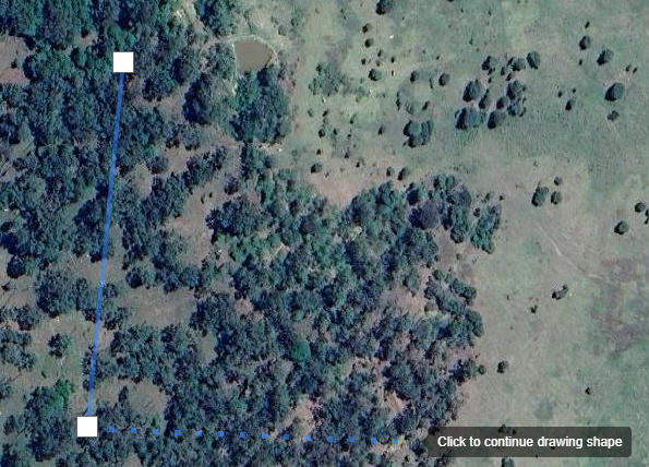
Once fields are entered, move cursor over the map to draw the borders. It will say 'click to start drawing shape' before you select the first point. Once you select starting point, start drawing borders for the block. A solid line shows a set line, dashes/dots show the line currently being drawn, and will turn solid when the next point is added.
Once all borders are drawn, select the first point created to complete/close the geofence. All area within the geofence will be highlighted.